
We provide a range of geophysical services for archaeological applications, including magnetometry, magnetic susceptibility, ground penetrating radar, earth resistance and electromagnetic ground conductivity techniques.
Magnetometers and magnetic susceptibility meters are commonly used for rapid reconnaissance archaeological assessments, facilitating the detection of subsurface features associated with human activity.
Our detailed magnetometer surveys utilise a standard 0.5m traverse increment, ensuring high-resolution data that accurately identifies magnetic anomalies beneath the surface. This technique allows for the identification of buried archaeological features, including cut ditches, pits field systems, trackways palaeochannels, as well as fired remains, such as hearths and ovens, along with accumulations of ferrous metal.
To cover expansive areas, magnetic susceptibility sampling can be conducted at intervals of 10m or 20m. This approach helps in identifying points of enhanced magnetism, which can subsequently be targeted by a more comprehensive magnetometer survey.
Ground penetrating radar (GPR) stands out as a versatile technique applicable in various archaeological scenarios, useful to both greenfield and hardstanding environments. This method provides real-time imagery, presenting the subsurface as a vertical radargram. Alternatively, data collection over an orthogonal grid allows for further post-processing, enabling the creation of horizontal timeslices to assist in analysis.
GPR data offers valuable depth information for potential anomalies, establishing it as a valuable standalone technique and a complement for the targeting of features identified through methods like magnetometry or electromagnetic conductivity.
When utilising mid-to low frequency antennas, GPR can detect buried structural remains, graves, cut ditches, roads, tracks as well as voids and buried military infrastructure. Additionally, it proves effective in identifying features associated with former historical gardens.
For near surface investigations, high-frequency GPR becomes particularly beneficial. This capability is well -suited for examining structural features such as walls and floors in churches, cathedrals and domestic structures, enabling the identification of under-slab graves, crypts, voids, chimney flues and former doorways.
Earth resistance surveys serve as a valuable tool for mapping buried features, including walls, buildings, cists and roads. Conversely, the technique is adept at detecting conductive pits, ditches and graves.
This method is versatile, capable of independent use in areas predominately featuring buried stone structures or as a supplementary tool to target anomalies identified by a magnetic assessment. Earth resistance surveys, in particular, prove effective for the assessment of churchyards and burial grounds.
.
.
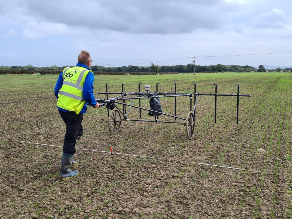
Fixed frequency electromagnetic surveys prove invaluable for detecting a range of buried features, including structural remains, ditches, former paths and tracks. Notably, the in-phase component of the survey operates as a metal detector.
Employing induction principles to measure subsurface electrical conductivity, electromagnetic surveys eliminate the need for direct contact with the ground, distinguishing them from earth resistance surveys. This makes electromagnetic surveys suitable for areas where resistance surveys may not be feasible.
Typically, instruments used for archaeological assessments provide a depth of penetration ranging from approximately 0.7m to 1.5m in horizontal and vertical dipole modes.
For deeper investigations, instruments providing a depth penetration of approximately 3m to 6m in horizontal and vertical dipoles become necessary. This increased depth capability is particularly beneficial for detecting large, deep features such as defensive ditches, structural remains or military bunkers, in both hardstanding and greenfield environments.
Time-domain instruments, functioning as high-resolution metal detectors, can locate both ferrous and non-ferrous targets to depths exceeding 3m below ground level, dependent upon the size and volume of the material. This technique proves especially valuable for investigating military sites and detecting downed aircraft including any associated ordnance.
Let’s Talk.
If our services resonate with your requirements or if you’d like a quotation, reach out. Our team is eager to discuss how we can assist in making your projects a reality.