
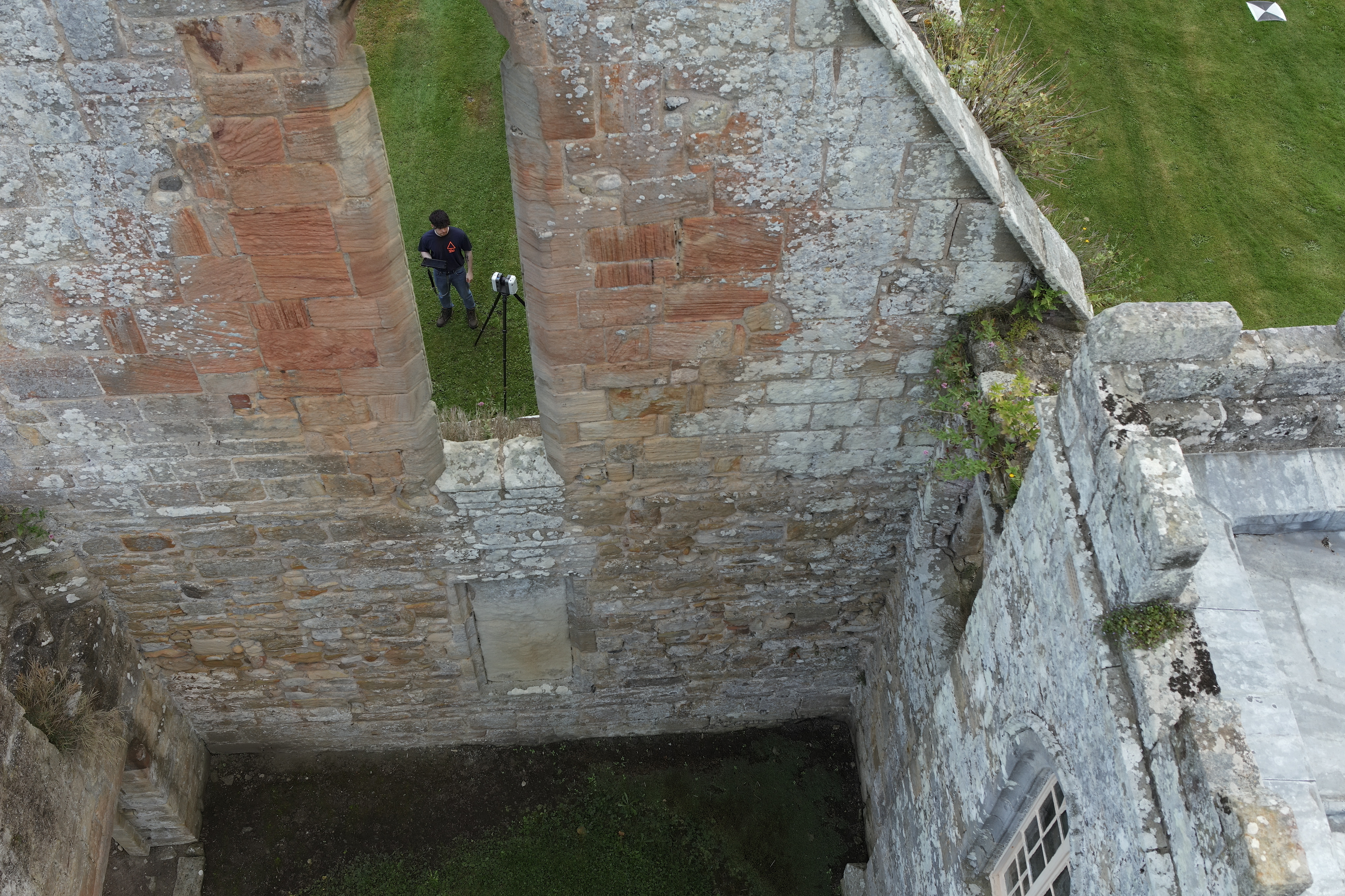
Laser scanning is a powerful technology that ensures accurate surveys from the outset. By employing fast and reliable scans using laser light that captures millions of highly precise three-dimensional data points, we can create a comprehensive representation of a structure or site in a single visit, enhancing project efficiency and accuracy.
Speed and precision: Terrestrial laser scanning can capture over a million data points per second, providing rapid and highly accurate 3D data collection.
Point Cloud Generation: The collected data is used to create a point cloud, a digital representation of the physical space, capturing intricate details of archaeological and heritage sites.
Preservation: The detailed 3D data aids in the preservation of heritage sites by documenting their current condition. This information is invaluable for future restoration efforts, ensuring accurate restoration to comply with heritage guidelines.
Condition Monitoring: Ongoing scanning allows for the monitoring of structural changes or erosion over an allotted time period, helping to identify potential issues early on and facilitating proactive conservation efforts.
Digital Reconstructions: Laser scanning combined with modelling services enables the creation of 3D representations that can be analysed for research, documentation and conservation purposes.
Comparative Studies: Point clouds and 3D models can be compared to historical data or between differing time periods, allowing for in-depth analysis of changes and trends.
Visualisation: The 3D data can be utilised in media presentations, providing immersive and visually engaging experiences for educational or public outreach purposes.
Detailed Representations: Our Revit modeling services offer the creation of 3D models based on the laser-scanned data, providing a high level of detail suitable for specific project needs.
Export to Computer Aided Design: The Revit models can be exported to AutoCAD, facilitating the creation of highly accurate elevations and floor plans for architectural and engineering purposes.
Integration With Photography: Laser scanning combined with photography allows for the creation of photorealistic composite scale models, enhancing the visual appeal and realism of the digital representations.
Analytical Foundation: These scale models can serve as a foundation for further analysis, aiding researchers and conservators in their work.
Let’s Talk.
If our services resonate with your requirements or if you’d like a quotation, reach out. Our team is eager to discuss how we can assist in making your projects a reality.